情報提供
How to Use

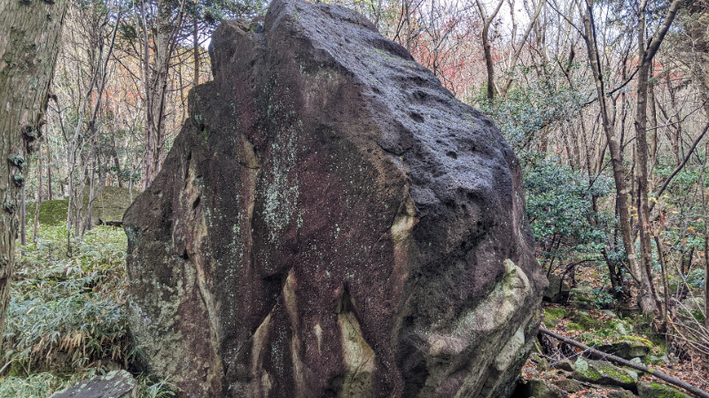
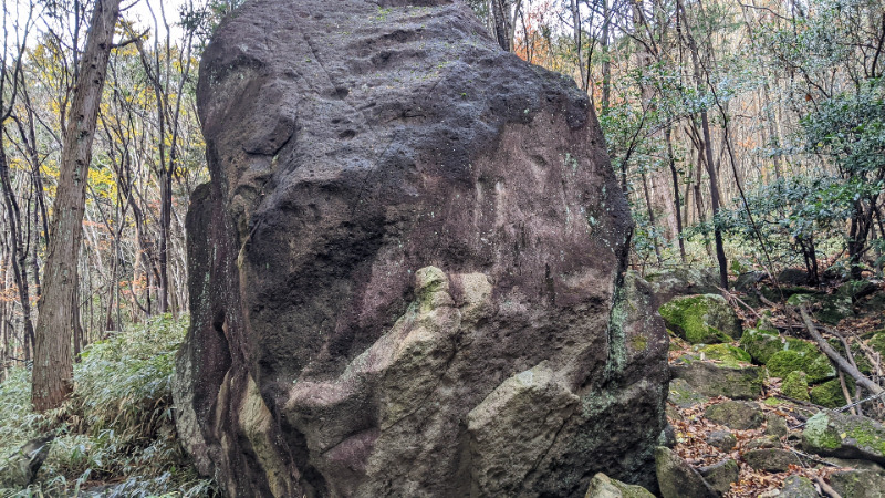
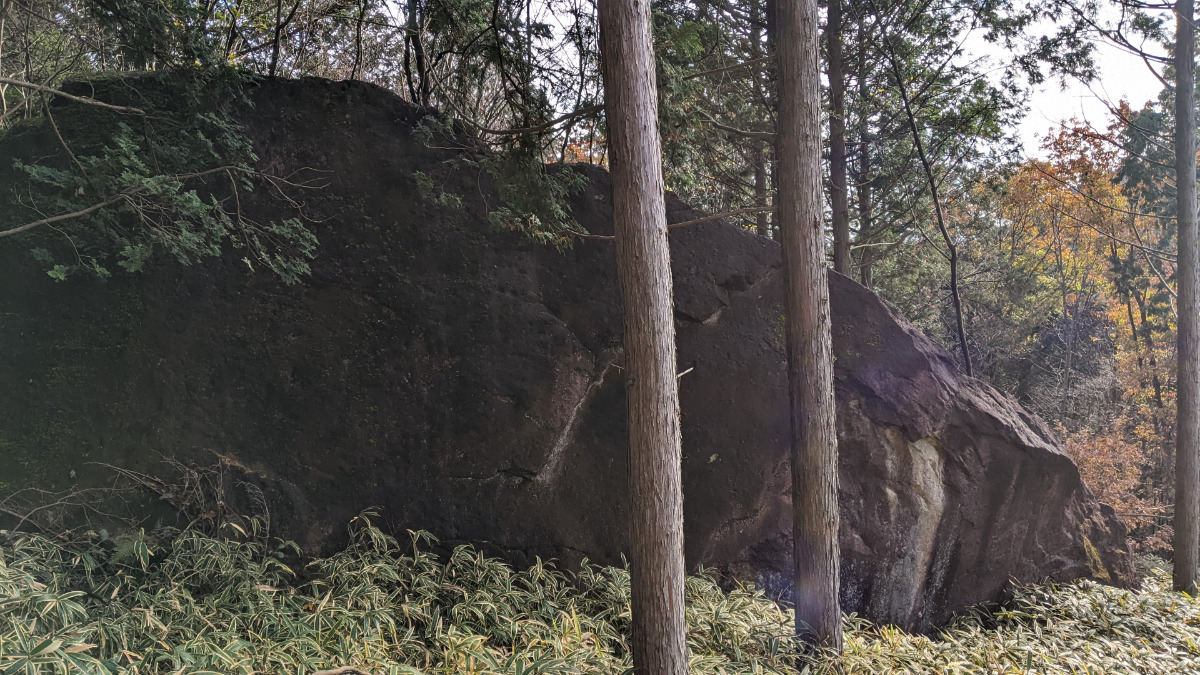
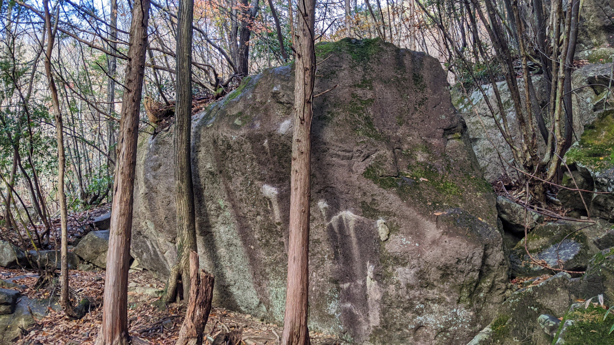
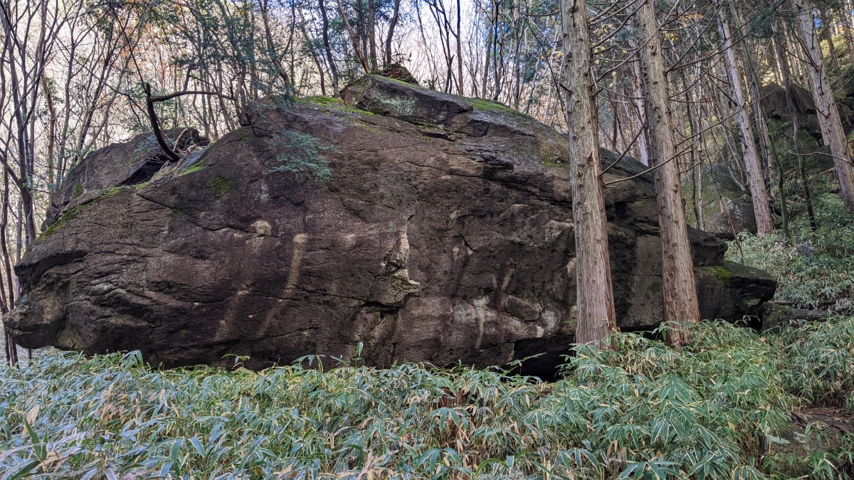
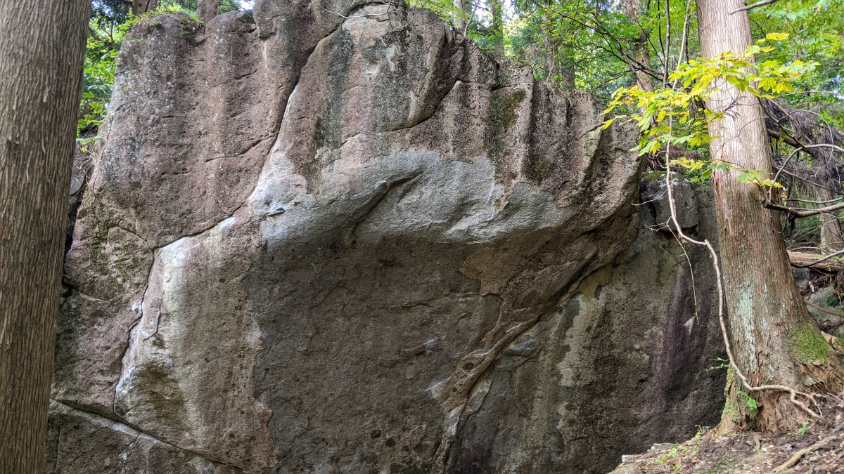
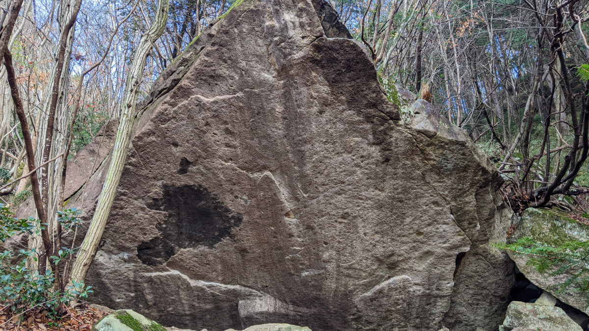
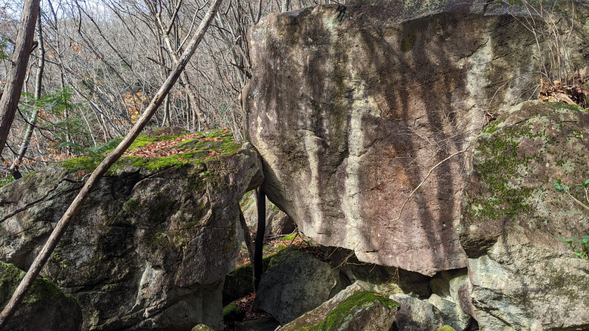
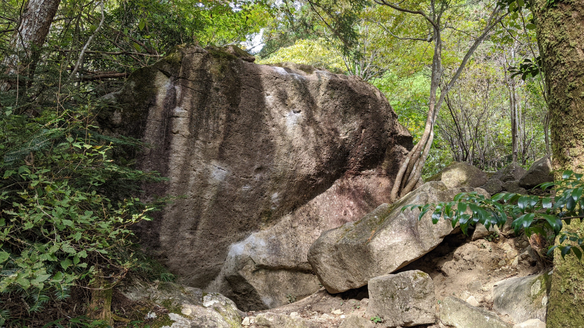
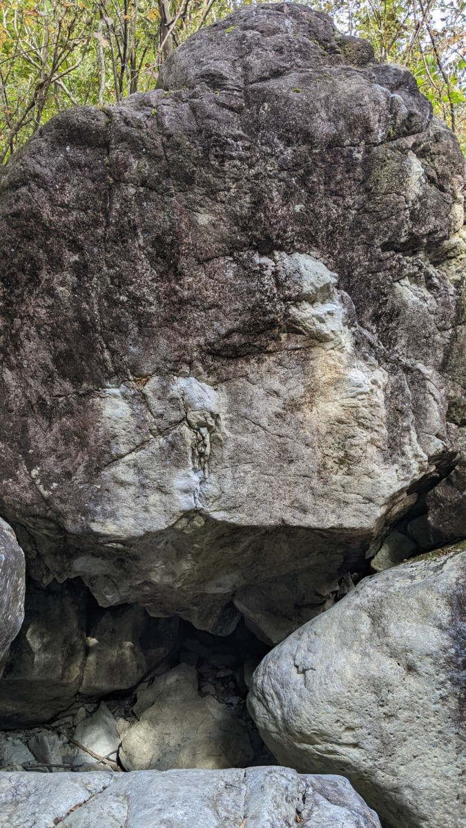
はぐれ岩
Basic Info
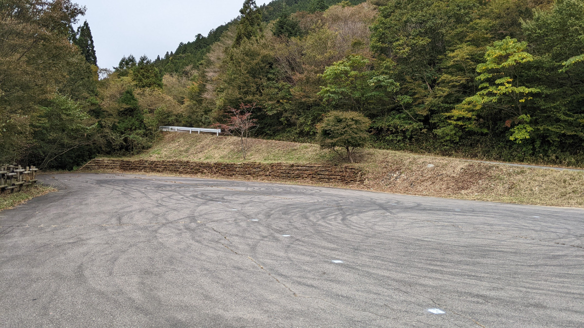
| Area Info | 岐阜県 / フクベ 中流エリア / |
|---|---|
| GPS Location | 35.6359339,136.8910113 |
| Elevation |
Approx. 664 m
Parking Elevation Approx. 716 m(Diff:-52 m) |
| Distance from Parking | 591 m |
Route Distribution
Tap the bar chart to view routes for each grade.
ボルダー(6 routes)Routes
Tap red lines to show route name and grade
簡単
4~3級
2~1級
~三段

Loading...
動画
-
※自動抽出の動画
-
※自動抽出の動画
Comments
No comments yet.
Post CommentNearby Crags
象さんスラブ
フクベ
中流エリア
35.6360075
136.8905537
0
6
0
0
0
象さんスラブ
- フクベ / 中流エリア
- タイプ別: B6
- 難易度別: E6
- 駐車場から: 近め -96.7191789710433474
リローデッド
フクベ
中流エリア
35.6360394
136.8919528
0
2
0
0
0
リローデッド
- フクベ / 中流エリア
- タイプ別: B2
- 難易度別: M2
- 駐車場から: 近め -37.0072581331961925
ザイオン・楓岩
フクベ
中流エリア
35.6363592017377
136.8922407570431
0
8
0
0
0
ザイオン・楓岩
- フクベ / 中流エリア
- タイプ別: B8
- 難易度別: E1 M7
- 駐車場から: 近め -1.95050526087678
ジルコンの岩
フクベ
上流・川エリア
35.6353347
136.8892458
0
2
0
0
0
ジルコンの岩
- フクベ / 上流・川エリア
- タイプ別: B2
- 難易度別: H2
- 駐車場から: 登り返し有 -164.4988565161516377
マトリックス岩
フクベ
中流エリア
35.6362208
136.8931055
0
6
0
0
0
マトリックス岩
- フクベ / 中流エリア
- タイプ別: B6
- 難易度別: M1 H5
- 駐車場から: 近め 80.4476992714690986
カエル岩・大山椒岩
フクベ
中流エリア
35.6366574
136.8930173
0
6
0
0
0
カエル岩・大山椒岩
- フクベ / 中流エリア
- タイプ別: B6
- 難易度別: E5 M1
- 駐車場から: 近め 74.9628400819612248
朽木岩
フクベ
上流・川エリア
35.6349001
136.8891408
0
2
0
0
0
朽木岩
- フクベ / 上流・川エリア
- タイプ別: B2
- 難易度別: M2
- 駐車場から: 登り返し有 -202.1153810929384188
ヤゴの岩
フクベ
上流・川エリア
35.6347056
136.8892389
0
1
0
0
0
ヤゴの岩
- フクベ / 上流・川エリア
- タイプ別: B1
- 難易度別: H1
- 駐車場から: 登り返し有 -217.48058300871288
Loading...
×