情報提供
How to Use
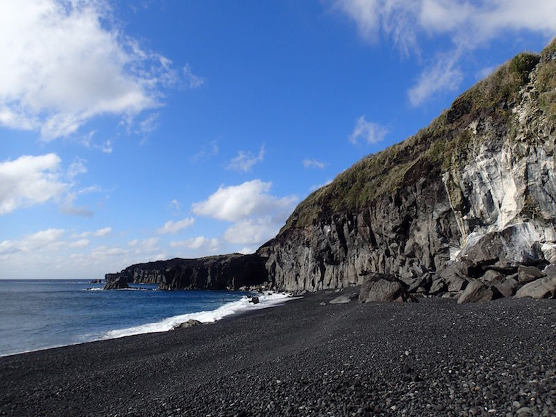


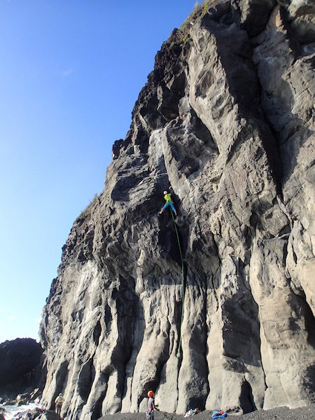
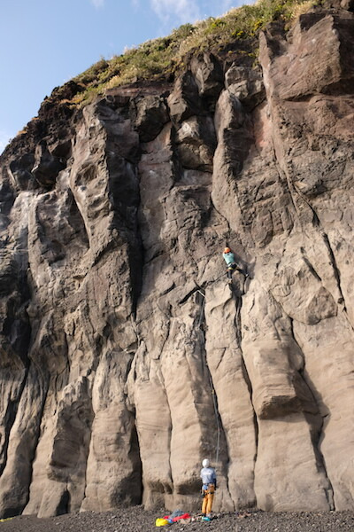
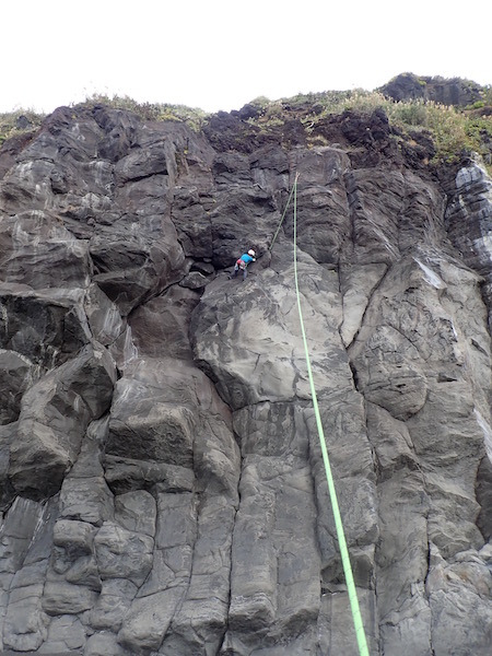
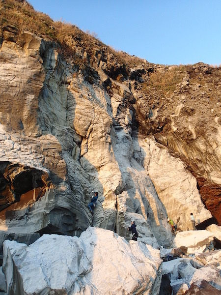
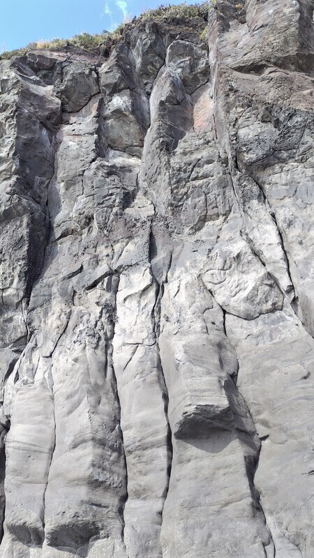
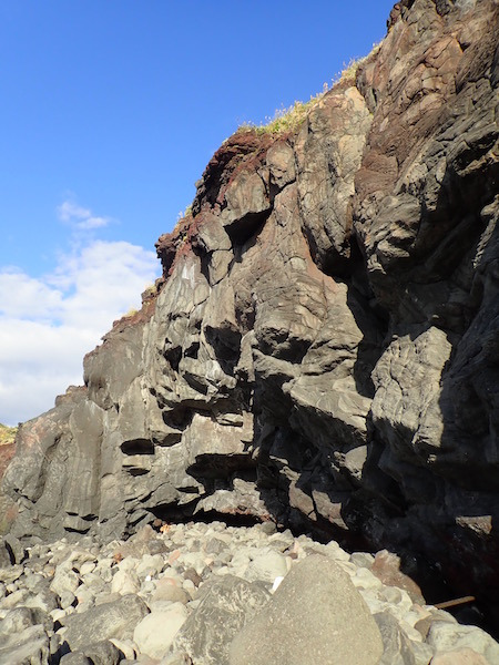
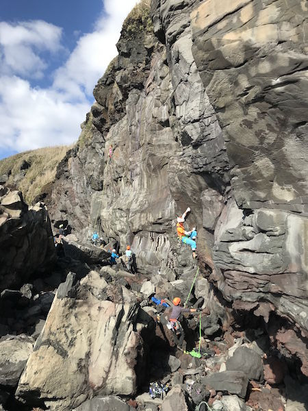
PO壁
Basic Info
| Area Info | 東京都 / 三宅島 |
|---|---|
| GPS Location | 34.05211776036533,139.48879078132796 |
| Elevation |
Approx. 3 m
Parking Elevation Approx. 45 m(Diff:-42 m) |
| Distance from Parking | 123 m |
Route Distribution
Tap the bar chart to view routes for each grade.
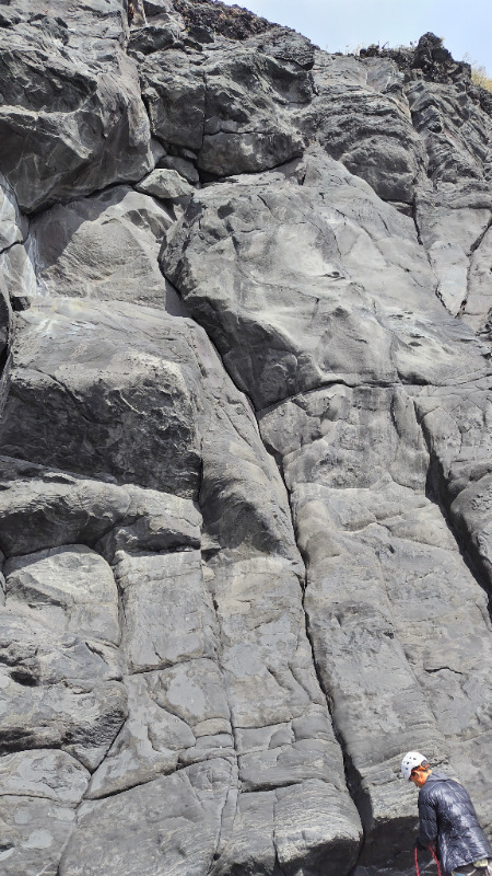
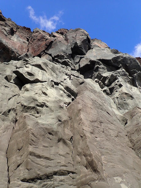
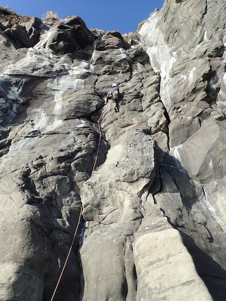
リード(クラック)(26 routes)Routes
Tap red lines to show route name and grade
-
最奥エリア
-
中央エリア
-
右エリア
-
-
-
滝の右エリア
簡単
5.10台
5.11台
クラック
フェイス
MIYAKE INTRODUCTION
リード(クラック)
5.9
1
0
0
0
34.05211776036533
139.48879078132796
ネックウォーマー
リード(クラック)
5.10b
2
0
0
1
34.05211776036533
139.48879078132796
見返り御蔵
リード(クラック)
5.10d
2
0
0
1
34.05211776036533
139.48879078132796
.JPG)
積木くずし
リード(クラック)
5.10a
2
0
0
1
34.05211776036533
139.48879078132796
.jpg)
飛沫の中
リード(クラック)
5.9
2
0
0
1
34.05211776036533
139.48879078132796
君の知らない物語
リード(クラック)
5.10c/d
1
0
0
0
34.05211776036533
139.48879078132796
リアル大奥バリエーション
リード(クラック)
5.9
1
0
0
0
34.05211776036533
139.48879078132796
Loading...
動画
-
※自動抽出の動画
Comments
No comments yet.
Post CommentNearby Crags
黒潮壁
三宅島
34.052525274091806
139.4863712004911
0
0
0
13
0
黒潮壁
- 三宅島
- タイプ別: C13
- 難易度別: E6 M7
- 駐車場から: 近め -7.2943718409845934
冨賀浜
三宅島
34.056217205164046
139.48119074106216
0
0
0
11
0
冨賀浜
- 三宅島
- タイプ別: C11
- 難易度別: E7 M4
- 駐車場から: 近め -10.984220278012926
新鼻
三宅島
34.04757820498281
139.49843816594046
0
0
0
10
0

新鼻
- 三宅島
- タイプ別: C10
- 難易度別: E5 M4 H1
- 駐車場から: 近め -23.5104458915782656
Loading...
×