情報提供
How to Use
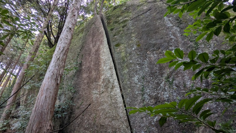
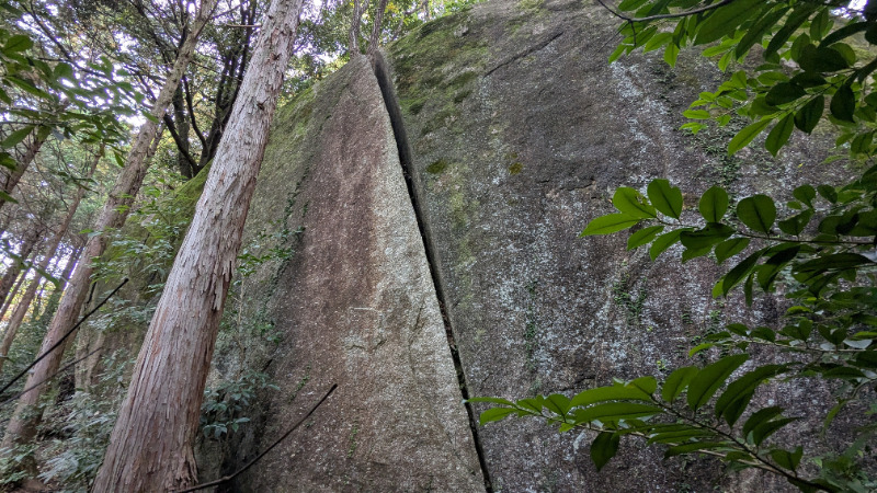
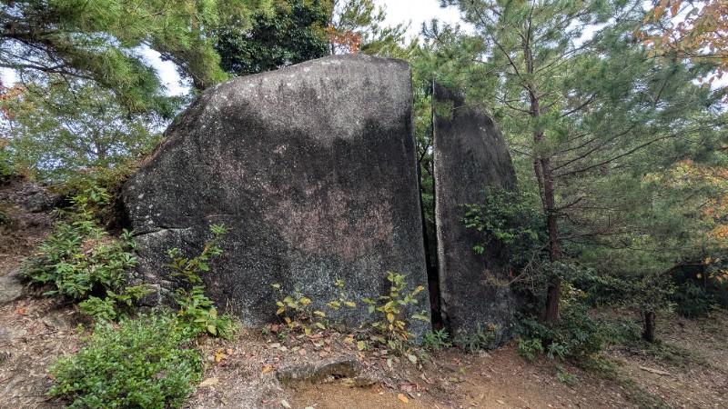
大クラック岩
Basic Info
| Area Info | 愛知県 / 豊田 梟城址エリア / |
|---|---|
| GPS Location | 35.066399,137.2380084 |
| Elevation |
Approx. 220 m
Parking Elevation Approx. 221 m(Diff:-1 m) |
| Distance from Parking | 1209 m |
Route Distribution
Tap the bar chart to view routes for each grade.
ボルダー(1 routes)
Routes
Tap red lines to show route name and grade
簡単
4~3級
2~1級
~三段
Loading...
Comments
No comments yet.
Post CommentNearby Crags
遊歩道横の岩
豊田
梟城址エリア
35.0668159
137.2376255
0
3
0
0
0
遊歩道横の岩
- 豊田 / 梟城址エリア
- タイプ別: B3
- 難易度別: E2 M1
- 駐車場から: 近め 109.6211617065717975
千鳥ロック
豊田
梟城址エリア
35.0671688
137.2379826
0
2
0
0
0

千鳥ロック
- 豊田 / 梟城址エリア
- タイプ別: B2
- 難易度別: M2
- 駐車場から: 近め 60.9249364938688371
勿忘草ロック周辺
豊田
梟城址エリア
35.0673557
137.2376731
0
7
0
0
0
勿忘草ロック周辺
- 豊田 / 梟城址エリア
- タイプ別: B7
- 難易度別: E2 M3 H2
- 駐車場から: 登り返し有 -474.708158518304457
背筋ロック周辺
豊田
梟城址エリア
35.0675969
137.2381847
0
7
0
0
0
背筋ロック周辺
- 豊田 / 梟城址エリア
- タイプ別: B7
- 難易度別: E4 M3
- 駐車場から: 近め 16.0572796986758751
でんでんむしロック
豊田
梟城址エリア
35.067581
137.237249
0
4
0
0
0
でんでんむしロック
- 豊田 / 梟城址エリア
- タイプ別: B4
- 難易度別: E3 M1
- 駐車場から: 近め 92.545170161505462
天晴れロック周辺
豊田
梟城址エリア
35.067646
137.2372738
0
14
0
0
0
天晴れロック周辺
- 豊田 / 梟城址エリア
- タイプ別: B14
- 難易度別: E10 M3 H1
- 駐車場から: 近め 80.7161069984002008
球根ロック周辺
豊田
梟城址エリア
35.0677983
137.2373157
0
10
0
0
0
球根ロック周辺
- 豊田 / 梟城址エリア
- タイプ別: B10
- 難易度別: E3 M6 H1
- 駐車場から: 近め 54.5796965983162002
初陣ロック周辺
豊田
梟城址エリア
35.0675944
137.2367645
0
22
0
0
0
初陣ロック周辺
- 豊田 / 梟城址エリア
- タイプ別: B22
- 難易度別: E12 M10
- 駐車場から: 近め 81.4496645917535856
Loading...
×